 David Nicholson is making use of the World Wide Web to compile and publish annotated histories of the license plates of North America since 1969. This is a huge enterprise and we should all be glad he’s undertaken it.
Category Archives: History
LINK: Explore SEFT-1
The mission statement is in Spanish, which means my understanding is fuzzy, but some guys created an automobile that will run on both paved road and train tracks. Why? To explore the abandoned rail line that runs from Mexico City to the Pacific Ocean, and find out about the people along the way who have been affected.
The slide shows from the explorations are cool, with some narration that is in English as well as Spanish.
Some Ukraine Illumination
Reading stories about the bloody riots in Ukraine, it was difficult to know what was really going on. Who was protesting and why? The answers and explanations were often contradictory, once you got past the obvious issues with the government.
This VICE documentary does a pretty good job of showing the diversity of ideology among the participants in the Kiev protests, represented by different groups fighting the current government.
Prime movers are the nationalist Right Sector, right wingers, but there is also a serious progressive element to the protests, as well as a more mainstream group. For now, at least, the different sides are joined by their mutual hatred for the present government and fear of Russian annexation.
The bottom line is that the people of Ukraine are standing up to the government and its special police (the regular police are refusing to act against the protestors) in decisive and dramatic terms, even though they themselves don’t agree about what comes next.
Time Zone Slippage Illustrated
Stefano Maggiolo explains a number of the issues involved with local time, solar time and standard clock time in The Poor Man’s Math Blog, and he created this map that highlights the areas where standard time leads solar time (green) and where it lags (red).
 Until mechanical clocks and faster transportation became more common in the early 19th Century, local time based around noon, when the Sun was at its highest point in the sky, was all that mattered. (click map for larger image.)
For reasons Maggiolo explains, local noon varies based on latitude and time of year. Once instantaneous communication connected localities, via telegraph at first, and soon after railway schedules, a standardized time was increasingly important. Maggiolo goes into this in brief but interesting detail.
Looking at the map, I wonder why there is so much dark red near the poles (having the sun come up later makes less difference when winter is nearly all dark and summer is nearly all light) and in China (officially, it turns out, China has only one time zone across its vast expanse).
I’ve almost always lived near the center of time zones, but have noticed that the texture of life changes when the sun comes up earlier or later. Despite our efforts to tame time, its inexorable rhythms shape our experience in often unconscious ways.
This map helps visualize at least one of those.
On The Road, With Maps and Directions
 When I was a high schooler I was obsessed with Jack Kerouac’s On The Road. I read the novel multiple times and I read all of Kerouac’s other novels, there are many, some of them multiple times, the better to understand it and him.
I exulted when Visions of Cody, something of a companion piece to On The Road, was released, full of diary fragments and transcribed recordings of conversations between Kerouac and Neal Cassidy (Dean Moriarity in the novel), and my friend Peter and I went to a seminar at Hofstra University where a professor played recordings of some of those very conversations. At the time, just a few years after Kerouac’s death, much of his output was still hidden in the cardboard boxes of his papers and other items he left behind.
It was enough to keep a pipe of ephemera and data flowing for the forty years since, which is why I ate up the original scroll version of On The Road a few years back (truly exciting) and the “lost” collaboration between Kerouac and William Burroughs, which was released some few years ago, The Hippos Were Boiled in Their Tanks (surprising lively and moving), even though I no longer obsess over him, or the book.
My buddy Russell and I even planned on hitchhiking to Colorado for the summer following 11th grade, though our moms talked us into taking the Greyhound instead. Which was fine, because Jack often rode the Greyhound in the fellahin night of red brick sunrises, too. But once we landed in Evergreen we headed out to the Grand Canyon by thumb, dodging the highway patrol and the crazed, finding the heart of America inside the cabins of the cars and their drivers that carried us safely there and back. Just like Jack did, haunted along the banks of the Susquehanna by a shade or a memory or a portent, we found magic on the road, in whatever guise it came.
What I never thought to do was to map the actual roads Jack and Neal traversed, but it turns out just about everybody else has. Some examples.
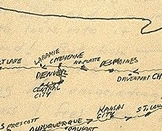
In Kerouac’s journal is a hand-drawn map of his cross country trek.
A guy named Dennis Mansker has made interactive Google maps of all the trips in On The Road, full of odd and arresting details.
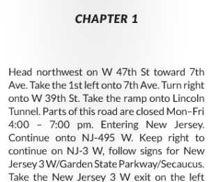 A guy named Gregor Weichbrodt input all the hard destinations listed in the book into Google Maps and asked for directions. The step by step routes are spontaneous prose of a distinctly mechanical perspective, but wonderful (to me) for the mere idea of it.
The Oldest Subway Tunnel in the World
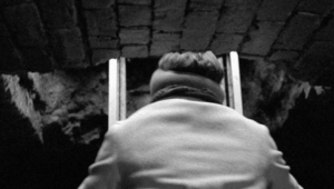 One day a few years ago I was walking along Atlantic Avenue in Brooklyn and there was a makeshift cordon of orange safety cones in the middle of the street, an open manhole cover inside the cordon, and a ladder sticking out of the manhole. There was also, at this busy intersection outside of Trader Joe’s, a line of mostly young people waiting to be escorted through traffic to the ladder, upon which they would descend into the subterranean… what?
Some of the people waiting told us there was an old forgotten subway tunnel at the bottom of the ladder and they were signed up for a tour of it. $15 they told us the tour cost, and while that seemed like a lot of money to see a hole, that hole looked awfully intriguing.
I didn’t hear much about the forgotten subway after that, I guess because—as this story in The Verge says—the city revoked the tour operator’s license to offer them. The history of the tunnel, its discovery by an intrepid young man, and the ways it defined and changed his life, makes for good reading.
The intrigue continues.
A Postcard from D.C.: March 2, 1964.
My aunt Dottie and Uncle Henry took me on a trip to Washington D.C. in 1964, with my cousins Kim, Karen and Steven. We visited the FBI, the Capitol (where I met Senator Jacob Javits), the Lincoln Memorial, and no doubt other hotspots.
We stayed in the Warwick, a venerable old hotel, and I marvelled that I could leave my coins on the sidetable all day and the room would be cleaned and they wouldn’t be taken.
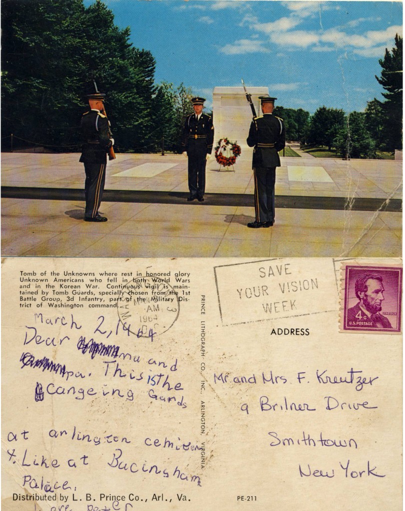
I wrote a postcard, apparently at first intended for my grandparents, but then cleverly made suitable for my parents, about our visit to Arlington Cemetery. Spelling is not great, but cute.


